© Stadt Bocholt
"Bocholt-Maps" contains all kinds of interesting geodata that is publicly available.City presents digital geoportal "Bocholt-Maps"
Tuesday, 27 February, from 7 pm at the Media Centre // Admission free
It's not just Google Maps or OpenStreetView: the city of Bocholt operates its own geodata portal "Bocholt-Maps", which is available to the public and provides lots of interesting local information. The administration is now presenting its digital map services to the public on Tuesday, 27 February, in the media centre. The event starts at 7 pm and admission is free.
Contents
Online map services such as Google Maps are playing an increasingly important role in the search for information on the Internet. The city of Bocholt also offers its citizens and service providers digital web and map services: the geodata portal Bocholt Maps. The Internet address https://maps.bocholt.de provides verified geodata including detailed information, background maps and thematic maps.
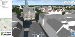
The diverse functions of the geodata portal will be demonstrated at the event, including the geodata apps, thematic maps and the digital 3D city model, which enables a virtual flight over Bocholt. It will be shown how to search for specific information, for example via the extensive database of points of interest (POI).
The geoportal also contains all kinds of information for different population groups. For example, children and parents can find information on schools, day-care centres and playgrounds. Senior citizens can find information on care facilities, senior citizens' groups and activities for the elderly. Information on tourism, leisure activities and planning and construction projects is also available. This includes standard land values, current building sites in the city area, the determination of areas and coordinates as well as the possibility of downloading development plans.
Applications
Registration is possible at the VHS Bocholt-Rhede-Isselburg offices or via the website www.vhs-bocholt.de. The event is free of charge.


